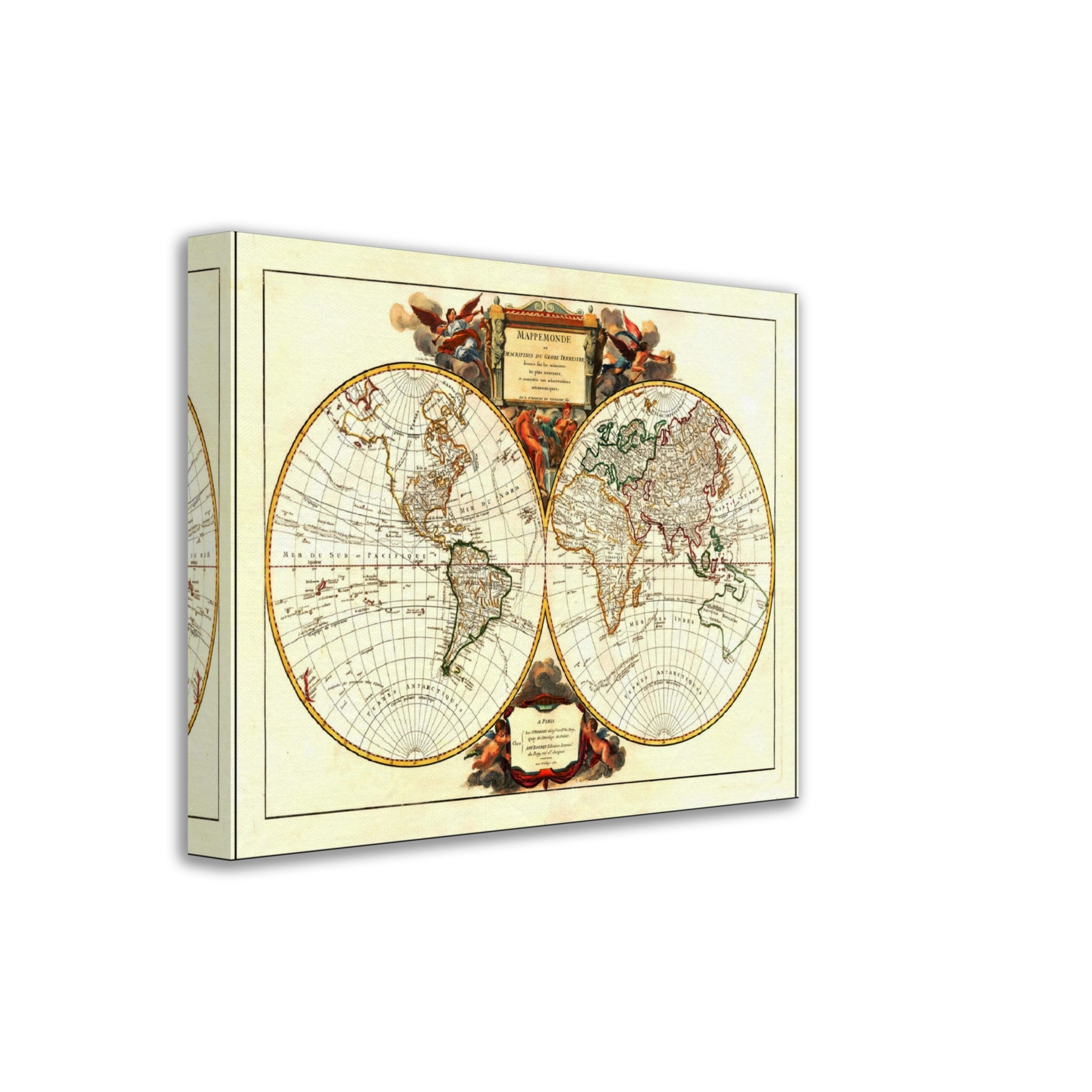
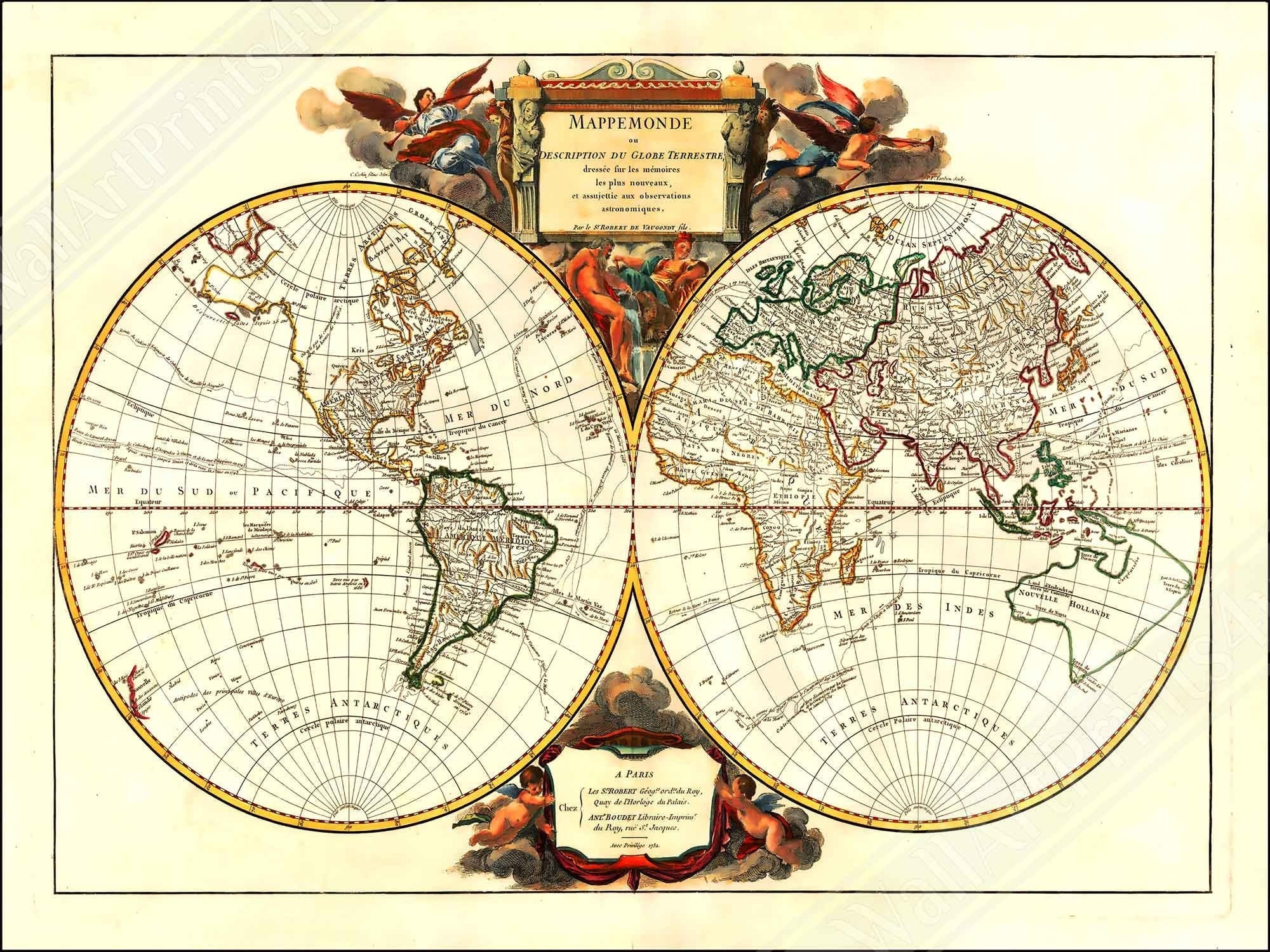
Old World Map Canvas Print From 1752.
✨ Vintage 1702 Map "Mappemonde Description Du Globe" Trivia:
Double hemisphere map of the world by renowned French mapmaker Gilles Robert de Vaugondy in 1702, first published in 1702.
It shows the latest discoveries in the 1740s
It also the Anson expedition and other voyages that took place in the late 1730s and 1740s and depicts a remarkable projection of Australia.
CANVAS PRINT & SHIPPING INFO
This listing is for a canvas print of various sizes, medium 10 x 8, 16 x 12, 20 x 16, 24 x 18 inches. Choose your size :-).
This is a uniquely restored enhanced image to get the most wonderful canvas possible.
All images used have been retouched to remove any major imperfections and then enhanced for digital printing.
The images are of the highest quality and 300 dpi.
This is a reprint, printed on high quality artist-grade poly-cotton blend canvas.
The canvas would look great on your wall, or as a present.
★ Beautiful canvas prints, printed on state of the art printers
★ Shipped from the UK for UK customers. We have a distribution center in the UK, mainly using Royal Mail, FEDex or UPS
★ Shipped from the USA for USA customers. We have distribution centers in the USA too, mainly using FEDex, UPS or DHL
★ Shipped from the EU for EU customers. We have a distribution centers Germany, France and other EU states
★ Shipped from AU & NZ for asia pacific customers
★ Canvas frames are made of FSC certified wood.
★ Digitally enhanced and remastered images
★ Mounting kit included, ready to hang
★ Artist-grade poly-cotton blend canvas
Canvas prints are carefully packaged with strong edges to protect the items. We also wrap the items in bubble wrap or kraft paper for additional protection.